NOTE: This text was originally uploaded in 2017 on my PNT hike. Lightly edited for typos.
I’m here at the Oroville Library, halfway through the PNT! It’s hard to explain what the past 5 weeks have been like, since every day you are traveling through new landscapes, meeting new people and wildlife. The pack keeps getting lighter, both in food and water that you can’t refill because the creek is surrounded by barbed wire, thick brush, and cow pollution. Its been tough to stay fully hydrated out here. Between the cows and the private property, it is tough to find a good water source to fill up from. Just makes for bigger carries out of the good sources. My next stop is the Pasayten Wilderness, a ~130 miles stretch of trail and natural beauty. Followed by the North Cascade NP, a similarly amazing piece of land. All told, between Cold Spring and Baker Lake the next two weeks will be extremely remote, and are supposed to be the highlights of the PNT.
Complicating factors is the 19,000 acre fire burning ~8 miles south of the PNT in the Pasayten. The National Forest Service (NFS) has put in a fire line to protect the PNT, but air quality will certainly be low, and visibility also affected. However, the weather is supposed to improve over the next week, and I hope the smoke clears a bit with favorable winds.
This last section between Republic and Oroville has improved on the previous segment, though there were still no views. John, Batman, Canyon and I decided to avoid some more road walking and cattle country by going straight through Republic, rather than going around the U. This saved ~60 miles of Forest Services roads and cow grazing lands. Instead, we started at Sweat Creek and made our way up and along the ridge above the creek for 9 miles of trail. There were a few small springs, but as you can guess, they were polluted by cows. 11 more miles of road brought us to Boneparte Lake, a beautiful spot to spend the evening. There is a “resort” there, complete with a restaurant, cabins, and running water. The 4 of us split a cabin, and enjoyed the sunset over the lake with some beer and ice cream.
We got a late start the next day heading up Bonaparte Mt, and I met my first East bounders, Cantalope and Honeydew. We talked with them for some time, before continuing up all the way to the top at 7200 ft, where there is a manned lookout. The tower has quite the setup, with electric lights and a propane stove. Sadly for the lookout on duty, and for us, the view was totally obscured by smoke. Still, we were able to fill up on some water which was a surprise up that high. Canyon and I got split up from John and Batman, so we camped at the base of the mountain, just before the end of the National Forest lands.
I ended up losing Canyon the next day, so I was camping solo in Whistler Canyon at a stream that, according to the guide book, was “good water”. Turns out, the stream was dry. The trails were great in that section of the Okanagan, and the Wilcox trailhead had an amazing sign that showed our route, along with an outhouse and picnic tables. What a luxurious place to have lunch and a nap. It was one of my longer days too, and according to the PNT maps I did 22 miles that day.
Yesterday I did a quick 5 miles before 9:30 AM into town. While check in at the Camaray Motel is usually 2:30, they were kind enough to let me check in for the night right then, and get a much needed shower. They even had free laundry for hikers, with some amazing soap and pre-treatment that took the black shoulder strap stains out of my shirt. I was hoping to take a 0 in town today, but since the motel is full tonight, I’m thinking I’ll head out today, though the first good camping spot is ~14 miles out, almost all paved roads.
I won’t be able to post (or receive anything) for the next 2 weeks at least as I made it through the Cascades, though once I’m in the Puget Sound area cell service and WiFi will abound. As always, feel free to send me an e-mail, and I hope you enjoy the photos below.
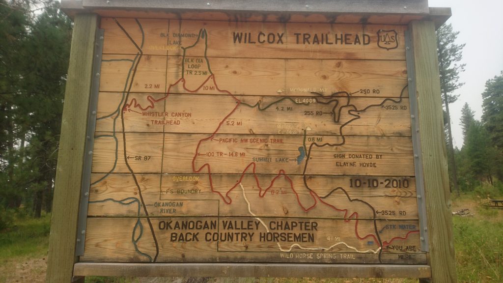
The trailhead sign at the Wilcox trailhead, showing the route for the next 14.8 miles.

A typical sign on the roadwalks between the national forest land.
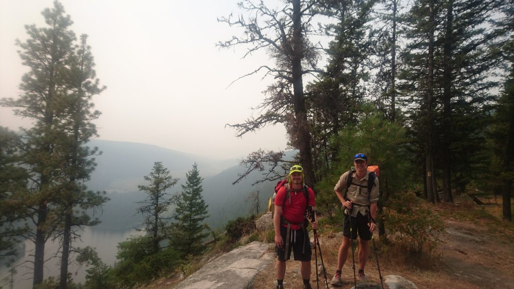
Canyon and I on the way up Bonaparte Mt, with the lake in the background.

A sign on the top of the mountain, a long hot climb to the top.

The trail out of sweat creek, an example of the high desert of the Okanagan highlands.