NOTE: This text was originally uploaded in 2017 on my PNT hike. Lightly edited for typos.
Fate smiles on us in the Pasayten. After weeks of smoke, obscuring every peak and view, the night I climbed into the Pasayten (5000′ in 8.9 miles!) a thunderstorm came through. We got perhaps 5 hours of rain between the storm at supper and some more rain overnight. Once it stopped, and the Sun came out, we found that the smoke had been blown away and washed out of the sky, leaving only amazing views and water in the streams. The skies have been free of smoke since, making what is supposed to be one of the best sections of the PNT truly amazing. Without the rain, Goodenough Mt, Apex Mt, Cathedral peak, Jack Mt, and Castle peak (to name but a few) would have all been obscured by smoke.
Despite the vast network of trails and beauty of the Pasayten, we didn’t see more than a handful of people in the ~120 miles we spent in the Wilderness. Perhaps we were too far north, with the nearest trailhead 16 miles south. Perhaps the 19,000 acre fire scared them away. It made for a mostly solitary trip, seeing only other thru-hikers and 4 rangers, giving us time to enjoy the view and slow down a bit mentally, but not physically. Doing 153 miles in 8 days requires keeping the pace up (average 19 miles (30 km) a day, every day), and really took a toll on me.
By the time I made it through the North Cascades NP doing a similar pace, I was feeling a bit burnt out. Things I didn’t consider when getting my permits, like having to do 2 passes (5000′ of climb, ~3000′ of descent in 17 miles) in one day to leave the park, caught up with me and made for long days. Combined with a ~2000 calorie per day deficit, I’ll freely admit morale was low near the end, despite the scenery and some amazing trail magic. I’m looking forward to this next stretch through the Puget sound area and Whidbey island as a chance to recharge, eat some good food, and prepare for the trek through the Olympic Peninsula.
Some highlights from this last section:
Tungsten Mine, which was active until the mid 1940’s. it still has two standing cabins where you can stay the night, complete with wood stove! There is even a spot to play horseshoes out front.
Apex pass -> Cathedral pass. 3.3 miles circling around a valley ringed with enormous cliffs, with Cathedral peak towering over everything.
Snowy Pass, just off the PCT gives you a taste of two worlds. East, you have the more subtle peaks of the of the Pasayten, with a spectacular valley below and some nice rock striations from the glaciers. West, you get bold and brazen North Cascades, with Castle peak to the northwest instantly grabbing your attention.
Devils Dome, with 360 degree views of mountains and glaciers galore. I was up here in the morning and nearly froze at 9:30, but would love to spend more time here.
Whatcom Pass. I saw the eclipse from up here, with the massive Challenger Glacier and Whatcom Glacier off to the south. Truly an amazing spot to watch the partial eclipse.
Baker Lake, Noisy Creek camp, definitely the best spot on the lake for camping, with amazing views of Mt Baker. I got a great view of the alpenglow behind the mountain, made the loop around the lake worth it.
And finally, some pictures for your viewing pleasure.

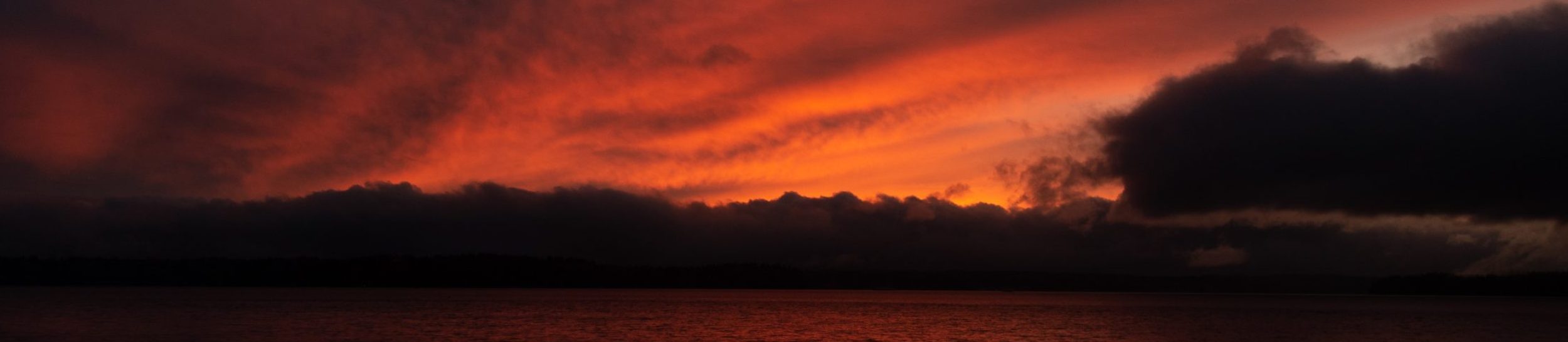
Mt Baker at Sunset, looking across Baker Lake.
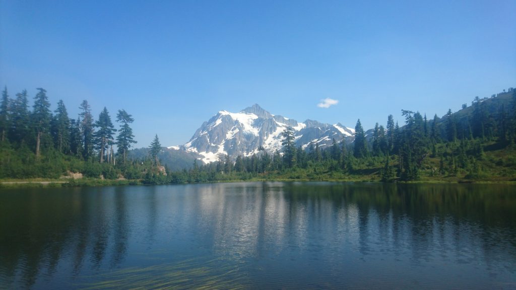
Mt Shuksan and its blurry reflection in Picture Lake. The crowds of tourists are nicely hidden from view.
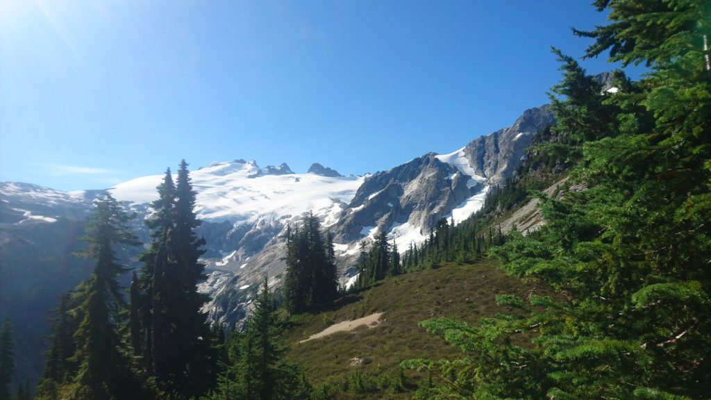
The enormous Challenger Glacier center, with the smaller Whatcom Glacier and peak off the the right. View from just south of Whatcom pass.

An enormous Cedar tree fell across the trail, this is what remains. Almost 6 feet in diameter, and smells great.
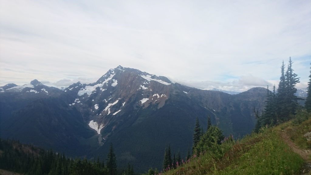
Jack Mountain, as seen from near Devils Dome.
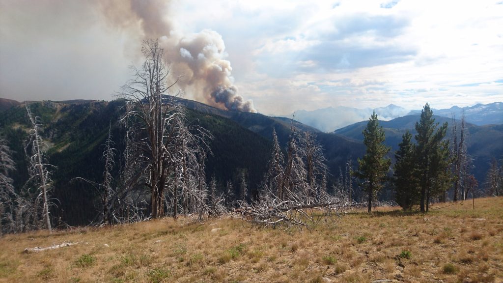
Smoke coming up from the Pasayten fire, ~8 miles south from the trail.
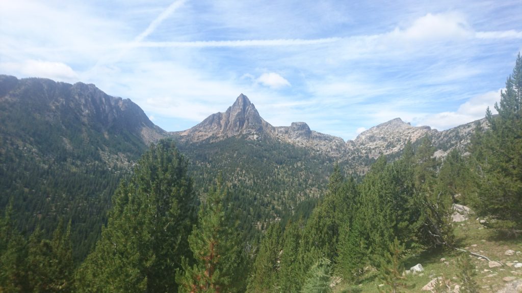
Cathedral peak, with the pass just to the left. The trail goes through there in a few miles.

Some high alpine meadows just past Goodenough Mt, near Louden Lake.